CTAF: 122.8
Lat :28º 58.241' N
Class :CA-REC
AvGas: No
Long:113º 33.52' W
Chart :GH 22__
 Remarks:
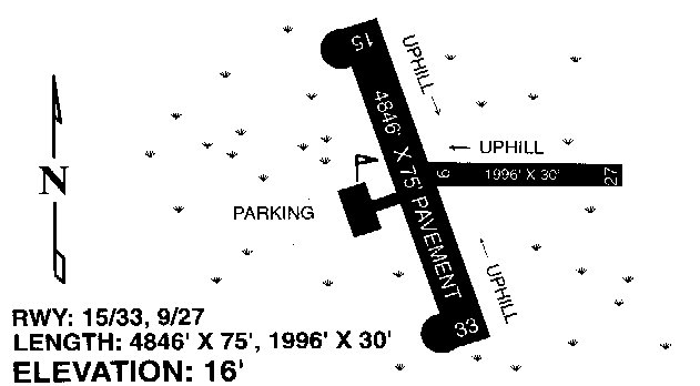
No line of site between Runway ends. Be alert for livestock, vehicles and
pedestrians. Prevailing crosswind to runway 15/33 make RWY 27 a good alternative
RWY. Excellent paved surface. Overfly town for taxi. No tie downs. Expect
to be detained by military for inspection. Last updated 6/97. Remarks:
No line of site between Runway ends. Be alert for livestock, vehicles and
pedestrians. Prevailing crosswind to runway 15/33 make RWY 27 a good alternative
RWY. Excellent paved surface. Overfly town for taxi. No tie downs. Expect
to be detained by military for inspection. Last updated 6/97.
|